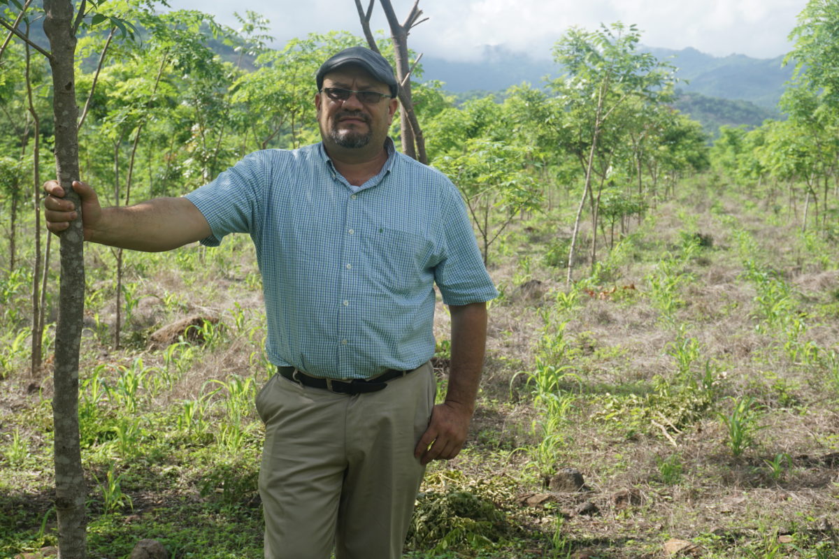
At Taking Root, we believe that the best opportunity to restore the world’s forests lies with the 500 million family farmers across the globe. Small-scale land managers have the potential to play a central role in mitigating climate change by incorporating reforestation activities into their existing land-use activities. Carbon finance could help unlock these activities, but reporting is a complex exercise.
One of the challenges in carbon reporting with smallholders is mapping the parcel(s) of land that will be reforested. While it sounds simple in theory, mapping smallholder parcels carries a host of challenges. For example, how do you map thousands of parcels in remote areas with little-to-no connectivity? What happens if a river intersects through the parcel of land being reforested? And in the absence of obvious boundaries, how do you make sure that you don’t accidentally include a neighbouring forest?
Here, we explain more about what it means to map a parcel, why accuracy is key, and how Taking Root’s approach brings rigour to mapping in smallholder carbon removal projects.
What does it mean to map a parcel and why is it important?
First, let’s clarify what is meant by ‘parcel’ and ‘parcel mapping’.
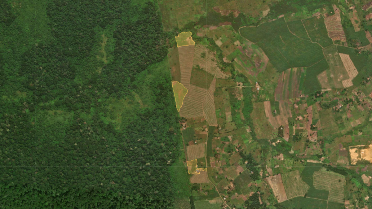
A parcel is an area of land designated for reforestation. A farmer can enter one or more parcels into a reforestation program, while continuing to use the rest of their land for existing agricultural practices. Mapping a parcel means tracing the perimeter of the land that is to be reforested. This delineates exactly where trees will be grown.
Parcel mapping is critical to a carbon removal project because it allows the carbon impact of an intervention to be calculated. Over the months and years to come, the parcel’s progress can then be assessed against the metrics that were originally observed. This verifies that the intervention is creating impacts which would not otherwise have been achieved. In the world of forest carbon removals, this is known as ‘additionality’.
To assess the parcel’s progress, technicians return to the parcel at regular intervals to record things such as tree height and diameter at breast height. The parcel map is integral to this exercise, as it ensures technicians know which trees are in and outside of scope, avoiding a situation in which the wrong trees are monitored.
Considerations when mapping smallholder carbon projects
The parcel map is, therefore, the starting point from which everything else flows. Given this, it is vital that parcels are mapped accurately. Inaccurate mapping can skew the data, meaning the wrong number of carbon credits is generated for the trees that are grown.
While mapping parcels accurately may sound straightforward, it presents more challenges than one might expect. For one thing, parcels are typically located in remote areas. When mapping with a GPS device, the GPS signal can “bounce” or suddenly jump away from its previous location. Typically, this is due to a loss of satellite signal, and it can throw mapping activities off course. There can be operational challenges on the ground too, as technicians may come across obstacles such as a house or river while mapping. Such obstacles need to be excluded from mapping activities, again to ensure accuracy.
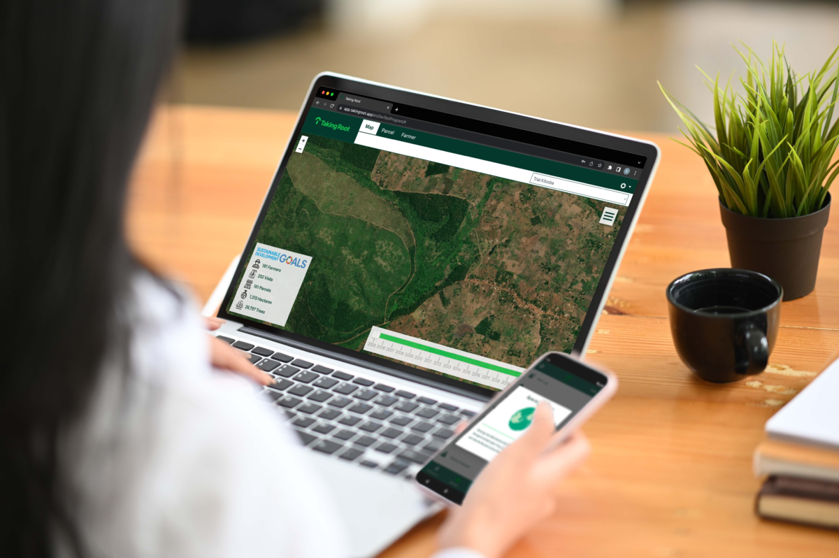
A technology platform designed for smallholder carbon projects
These considerations make mapping parcels in smallholder carbon projects particularly challenging. At Taking Root, we built a technology platform out of our own needs–specifically designed for smallholder projects. Our platform has two major components: a mobile app and a web app.
The mobile app is used for activities on the ground such as parcel mapping and monitoring tree growth. The data collected via the mobile app is integrated with our web app to quantify carbon and measure parcel performance. This makes it easy to report traceable and transparent carbon removals to a carbon standard. Various carbon standards exist, but Taking Root’s technology is informed by science-based methodologies that are approved by Plan Vivo.
How Taking Root’s technology platform improves efficiency and rigour
When it comes to mapping, our approach is to walk the perimeter of a parcel with the Taking Root app open on a mobile phone. The decision to leverage mobile phones was intentional as they are more accessible than specialist GPS equipment. The app automatically drops a pin every two seconds, leaving a “trail” so users can see what they’ve traced. Using GPS coordinates, the app then creates a polygon representing the parcel boundary. Creating polygons in this way is more efficient than other approaches, for example having a user manually add GPS waypoints to create the polygon . It’s also more accurate as it better reflects the reality of the parcel, in turn making it more equitable for farmers whose contracts are linked to the number of hectares being restored.
To promote accuracy, algorithms built into Taking Root’s technology platform rectify GPS errors encountered while mapping parcels. Our standard operating procedure tells technicians what to do if they come across an obstacle such as a river so it can be safely navigated, without compromising the integrity of the data. Once a technician finishes mapping, they can also see the polygon straightaway, meaning they can re-trace the parcel if they notice discrepancies.
Once the perimeter of a parcel is mapped and assigned its management unit (i.e., the type of forest design used) , the management unit and polygon area make possible to forecast the carbon that will be sequestered based on the project’s carbon models set out in its Project Design Document. All in all, this makes the process of parcel mapping and carbon quantification incredibly efficient. Importantly, it also requires minimal training to use, allowing parcel mapping to be completed by a range of users — including those without any previous forestry expertise.
When mapping activities are uploaded to Taking Root’s technology platform, it triggers a cycle of processing, reporting, and reviewing. Some of this is done through technology, and some of it is done through human processes. Various metrics are checked, including overlapping parcels. This added layer of rigour is built into our approach to guarantee accuracy and prevent errors such as double counting. Where small mistakes are identified, they can be fixed directly on the database. Otherwise, the parcel is escalated for a visual inspection and re-mapped where necessary.
Creating robust forest carbon removals
The outcome is a polygon that represents the area of land that is to be reforested. This sets the stage for success, ensuring precision when it comes to calculating the parcel’s carbon issuance. Moreover, this outcome is achieved with minimal training or effort from project implementers on the ground.
Mapping a parcel is just one step in managing a smallholder reforestation project. But it is foundational. Over the years, we have learned the challenges of mapping projects at scale and looked to technology to overcome them. Ultimately, while mapping smallholder parcels for reforestation can be a complex and challenging process, it is crucial to get right if we want to restore forests effectively.
Lottie Laken, Marketing & Communications Lead
Lottie shares and amplifies the impact stories from Taking Root’s forest carbon projects. Prior to joining Taking Root, Lottie worked as a freelance copywriter building powerful messaging for brands in a variety of industries. Before that, she was a content writer for a large legal services provider in the UK. Lottie holds a degree in English Literature from Cardiff University.